BRCK Expedition Pemba Photo Essay

I struggle to be like Erik and get my images edited and up on Instagram in the middle of chaos.  I come from the days of big cameras, film, darkrooms, and long periods between clicking the shutter and realising a final image.  I like to think about my pictures.  I’m never happy with them and I often return to Lightroom and edit them again and again until I at least don’t not like them.  This process does not lend itself to the instant forms of social media that we enjoy today.  While I continue to work on my publishing speed, I figured I might as well try my hand at a more contemplative photo essay following our journey on Expedition Pemba.


[foogallery id=”4034″]

Designing at the edge of the grid

A year ago, I coined a phrase that grounded my passion for human centered design and is the reason I wake up every morning. “Africa cannot afford un-contextualized design, the stakes are simply too high” never is this so true than in education.

One of the reasons I joined and love BRCK is because BRCK dares to go where others won’t. This week we’re in northern Kenya, a remote place with many challenges. Many don’t go to these extreme environments because of the geographical, social and economic constraints. However, we at BRCK hold a different point of view, that they matter and it makes both social and economic sense to design for the real Africa.

Mark Kamau taking quick notes as the teachers learn the Kio Kit

Mark Kamau taking quick notes as the teachers learn the Kio Kit

Tirrim Primary School is a good example. It is school in the desert, a long way up from Isiolo town, and has been the top primary school in testing in Marsabit County since 2008 sending their graduates to the most prestigious schools in the country. It is a charity school paid for by missionaries and has 620 pupils. Their dream, according to one of the teachers, is to become the “RVA (Erik’s former school) of the desert.” It is a lofty and worthy goal, especially considering people of Korr think on themselves as ‘Kenya B’ because of the sense of isolation and neglect of this desert folk feel from the rest of the country. Despite their limited access, these kids are expected to sit the same national exam and pitted against the same yardstick tablet wielding, smartphone trending students in Nairobi.

As a human centered designer with a passion for Africa, this is amazing territory. The Kio Kit sets out to answer a fundamental design question. ‘How can we convert any rural classroom into a digital classroom?’

In tackling this difficult challenge we made some assumption and learnt some lessons these are specific to this expedition.

1. CONTEXTUALIZED GUIDES

We set out to create guides for using the Kio Kit is English as it is the national language upon which all examinations are taken, but the role of local language in education, even when explaining technology is simply too effective to ignore. Today I observed a nuanced but interesting example. One teacher was trying to explain to a class of lower primary kids what the back button was on the tablet using conventional English and it took him a while to get them on board. Another said please click the “Khonjor” and all the students understood it immediately.

Some Rendille children on the Kio tablets

Some Rendille children on the Kio tablets

In the Rendille language Khonjor is a sickle, one the kids grow seeing their parents use for cutting plants. This shape allowed them to understand the reference as the blade points “back”. I also observed that even a few miles apart, the nuanced pronunciation of the same word meant the difference in understanding of things. While it is means more work, we have to contextualize the Kio Kit guides in localized videos.

2. COLLABORATIVE EXPERIENCES

With tablets, the idea is that students each get a tablet and are able to access content individually. In this construct, it is easy to diminish the importance of collaborative learning. The younger students are, the more they learn from observing and collaborating with each other. The content and games on the Kio Kit that we tested emphasized the need to have even more experiences in the Kio Kit that take advantage of this collaboration.

A teacher with the Kio tablet

A teacher with the Kio tablet

2. AUTHORITY CHALLENGE

The typical construct of a normal Kenyan school is that the teacher has the authority, they dictate what happens in the classroom and assume leadership, responsibility and authority. The tablet presents a different paradigm because with the tablet in their hands, the students have more responsibility than listening and writing. They play a more active role in their own learning. Handling this shift is challenging to teachers and their usual classroom control skills don’t directly apply. We therefore need to invest more time on classroom management training with technology.

There are many more lessons we have learnt from technical centered challenges to human centered challenges that energize us as we ride back home to make the Kio Kit work even better. Most of all, interacting with people motivates us to want to do even better.

Samburu women and digital education

Loading up the Kio Kits for our education expedition to Samburu

Loading up the Kio Kits for our education expedition to Samburu

The trip from Nairobi went well, as you can expect when you’re on the best roads in Kenya. There was only one small problem with a fuel line on the tired out old 1981 R80G/S when we got to Archer’s Post. I’m not bitter at all that my much nicer 2007 Suzuki DR650 is constantly overlooked by everyone as they drool over the old Beemer. We fixed the fuel line by finding a local motorcycle mechanic and raiding his parts bin.

Fixing a fuel line on the 1981 BMW

Fixing a fuel line on the 1981 BMW

Going offroad in Samburu

Shortly after, we shunted off of the main road into the dirt and made our way past Kalama town. Kiltamany Primary School lies about 15km past Kalama, and is the education facility for 170 children. We rolled into the school as the sun was setting, to the singing of the women in the community and the elders waiting for us for initial introductions.

An unexpected outcome of the evening was that we were going to be shown how the women are learning. Sylvester, the younger Samburu man who was responsible for this program, explained that he had built this program to teach the older women and mothers in the community how to read and do basic maths in order for them to understand the value of it. This encourages them to send their girls to school for the full first 8 years of primary school, and possibly beyond.

What was encouraging to see was just how hungry for learning the women in the community were. Sylvester asked us to be the teachers for the evening, so Nivi took over the classroom and worked through some mathematics with the ladies.

Teaching Samburu women

The Kio Kit was brought from the vehicle and the ladies watched a video on counting and number placement in Kiswahili. It’s by one of our partners, Ubongo Kids, out of Tanzania. This is one of the great values of the digital education kit, and our content agnostic approach, since we can partner with specialists on education content from anywhere and help get distribution of their content to the far edges of the country.

The Kio Kit about to be introduced to Samburu women

The Kio Kit about to be introduced to Samburu women

Digital education for Samburu women

Digital education for Samburu women

We ended the night with the Samburu elders showing us a luga (dry riverbed) and leaving us to camp for the night. Most places don’t have great connectivity, but we’re getting fairly strong 3g reception here and are able to do posts like this fairly easily.

Day 2 is going to be spent with the children from the school. Focusing on training up the teachers on digital tools like the Kio Kit and making sure that they’re comfortable, then doing some classroom exercises with the students.

BRCK Nile Expedition Redux

With all the hubbub about the team’s epic three week dash to South Africa and back, some may have forgotten that only a month and a half ago, the other half of the team were cruising Lake Victoria and the Nile in Uganda. The video edit is done, though, so we’re bringing it back!

We started off with a plan to work with Johnny Long of Hackers for Charity to connect schools around Jinja to the internet and learn from local educators how we can build technology that meets their needs:

http://brck.com/2014/11/brck-expedition-2014-exploring-edtech-on-the-water/#.VJP-mACU

We wound up visiting the Living Hope Secondary School on Lingira Island in Lake Victoria:

http://brck.com/2014/11/brcked-expedition-connecting-lingira-secondary-school/#.VJP–ACU

http://brck.com/2014/11/brcked-expedition-part-two/#.VJP-8ACU

On the boat ride back, we broke out our OpenROV underwater exploration robot:

http://brck.com/2014/11/going-deep-with-openrov/#.VJP_JACU

Finally, we took a raft trip down the White Nile to play with antennas and sensors, to see how the Internet of Things could help conservation efforts in threatened ecosystems:

http://brck.com/2014/11/how-the-internet-of-things-can-help-save-our-rivers/#.VJP_TACU

You can see all that and more (read: zany BRCK team adventures) in the video above. It’s been a heck of a year for us here in Nairobi, and we can’t wait to see what 2015 brings! (Did someone say they need a weather station on Mt. Kenya…?)

A Dash South, and Back Again

It has been 18 days since we left Nairobi for South Africa, then returned to Kenya. In that time, we passed through 8 countries, 18 border posts, covered 9,000 kilometers and saw some of Africa’s amazing beauty and realized just how vast of a continent we live and work on.

Sunrise riding is beautiful

Sunrise riding is beautiful

A BRCK Expedition is meant to be challenging, as well as provide a testing environment for the device, and of course to have fun as well – this was all of those things.

Philip fixes his broken throttle cable roadside, early morning in Tanzania

Philip fixes his broken throttle cable roadside, early morning in Tanzania

Our path to SA and back to KE

Our path to SA and back to KE

Through the BRCK, and partners like Inmarsat (with their iSavi device), we were able to stay connected on the road to the internet. We learned about the hassles of SIM buying, registering, activating, buying airtime and converting that to internet data in each country. On the motorcycles we stayed in conversation using Sena headsets, which meant we could warn each other of dangers, as well as have conversations on future products and features (of which there are many). Around campfires in the night we discussed our current challenges and ways we could make things better.

Inmarsat iSavi, BRCK, computer and solar panels

Inmarsat iSavi, BRCK, computer and solar panels

The team back home, as well as our families, tracked our progress and helped us remotely out of some problems. Whether that was trying to get the information on the gap needed on a 1983 BMW R65 spark plug, or finding a place for us to camp in the next couple hours when things got a bit dicey. Having the ability to communicate and people who anchor the expedition team were amazing luxuries to have.

We used a couple channels for public updates, including the BRCK Twitter and Instagram accounts, Open Explorer as our geographic diary of sorts, and of course the BRCK blog. However, on the trip north we also had a cool gift from the Inmarsat team of a satellite tracker for the vehicle.

The route back north to Kenya

The route back north to Kenya

A Few of the Best and Worst Experiences:

[BEST] Makuzi Beach Malawi – a beautiful, unexpected, and much welcomed oasis. We did amazingly well on our 500km that morning, so were there by lunch and had a whole afternoon to rest, fix things and have some fun before continuing.

Paul drives the underwater OpenROV

Paul drives the underwater OpenROV

Matt catches this amazing sunrise in Lake Malawi

Matt catches this amazing sunrise in Lake Malawi

[BEST] Hospitality of Tech Communities in Africa – It was amazing to roll into Lusaka, Zambia and be welcomed by the BongoHive and find the same in Harare, Zimbabwe from HyperCube and the tech community there. Finding like-minded individuals who were wonderful hosts was just what we needed.

At HyperCube in Harare, Zimbabwe

At HyperCube in Harare, Zimbabwe

[BEST] BRCK Working Everywhere – Having someone in the vehicle working to get the BRCK going with a new SIM in a new country, as it was attached to an amp and vehicular mounted antenna, meant that we could stay connected (almost always). Rolling up on the vehicle and watching my phone sync up with messages and updates was cool, even in traffic. Mostly, it was gratifying to see the tech we had built withstand the harshness of travel and terrain, and just work.

Kurt readies a BRCK with the Wilson signal booster

Kurt readies a BRCK with the Wilson signal booster

[WORST] Border Crossings – It’s a toss-up whether the Tunduma Border crossing from Tanzania into Zambia is worse than the Beit Bridge border crossing from South Africa into Zimbabwe. The first is a chaotic mess, and the second is a process nightmare. (Note: Crack-of-dawn is the best time to do both crossings)

Beit Bridge border process into Zimbabwe

Beit Bridge border process into Zimbabwe

[WORST] Speed bumps and Police in Tanzania – The speedbumps in every town slow you down, plus the number of police waiting to stop any vehicle. The worst are the ones with radar guns, as their only mission is revenue generation. It seems that all Tanzanian police are unsubtly looking for bribes all of the time.

A police officer in Tanzania not asking for a bribe

A police officer in Tanzania not asking for a bribe

[WORST] SIM card frustrations in new countries – Kurt wrote about this in a past post, so won’t belabor it, but it was extremely annoying to have to figure out the obscure and opaque mysteries of getting a SIM card connecting to the internet in each country. One of my personal goals is to make this easier for other travelers in the future.

Great roads and a bit of engine trouble (NBO2JHB day 1)

(By Erik)

I’m writing this blog post using my Mac, connected to a BRCK which is connected to a satellite internet connection using an Inmarsat iSavi device, somewhere about 100km from Arusha towards Dodoma. Inmarsat gave us this test device, a small unit, made for global travelers, so we could test out what worked and give them feedback on their tools. It also helps us figure out what connecting to the internet looks like when you’re beyond the edge of the mobile phone signal in Africa.

Here’s Reg, using his phone to do the same at our campground this evening:

Reg using the BRCK and iSavi in Tanzania

Reg using the BRCK and iSavi in Tanzania

The Journey

We left at 5:30am from Nairobi to beat the traffic out of the city. With the beautiful new roads, we were at the Namanga border by 8am and cleared by 10am. Before you go on one of these trips, make it easy for yourself and get the following:

  • Carnet de Passage for each vehicle (get this via AA)
  • COMESA insurance (get via your insurance company, or buy at the border)
  • International driver’s license (get via AA)
  • Yellow fever card
  • Passport

By noon we were in Arusha, and took a chance to see the cafe that Pete Owiti (of Pete’s Coffee in Nairobi) set up with some Tanzanians, called Africafe. If you ever find yourself in Arusha, this is the first place you should go. Great food, good coffee, right in the middle of everything.

Knowing we were only going about 100km more today, we set off around 1pm. We got to a roundabout, and I knew which direction the main road was, so even though Philip mentioned we should go right, I went left to the main road. 45 minutes later we realized my mistake when Philip checked his GPS and realized we were further away than we were supposed to be.

Lesson learned: always listen to your cofounders (especially the one with the GPS).

With many sighs, we turned around and went back to Arusha, where Reg had been smart enough to stay with the Land Rover when he realized we went the wrong way. We quickly split off in the correct direction, aiming to get to the camping spot by 4pm latest.

As we were sitting in traffic in Arusha, Joel says, “Erik, your bike is smoking.” I replied that it was likely just the car I was parked next to. Nope. Sure enough, I was leaking oil… For those of you who don’t ride motorcycles, this is the last thing you want to hear when on the front end of a 4,400km trip. I ride a 2007 Suzuki DR650 – they have some of the most bullet-proof engines, and are perfect for Africa’s roads.

Working on the DR650 in Arusha

Working on the DR650 in Arusha

Fortune smiled upon us, and we were pointed towards Arusha Art Limited, which turned out to be an amazing garage (the best I’ve ever seen in Africa). Their director, Hemal Sachdev helped us out by helping to troubleshoot what could be wrong, and even fabricating a high-pressure oil hose, with compression fittings on the spot. There was oil everywhere, so we washed it off and kept going.

Lesson learned: there are a lot of people willing to help you in your journey, especially if you ask nicely.

5 km down the road, I was still smoking… Thanks to Hemal’s help, we knew what the problem wasn’t. It was now that we chanced to notice that the problem seemed to be coming from the timing chain setting hole. We realized this could be filled by a normal M5 screw, so got trucking to the campground where we could let the engine cool down and screw it in.

Now, I sit here in Wild Palms Camp, some place we saw on the side of the road near the Tarangiri game reserve. For 10,000 Tanzania Shillings ($6) each, you get a patch of ground to put a tent, there is a banda with table/chairs, and there are even some showers and toilets. Not real camping, but definitely nice after a day on the bike!

How the Internet of Things Can Help Save Our Rivers

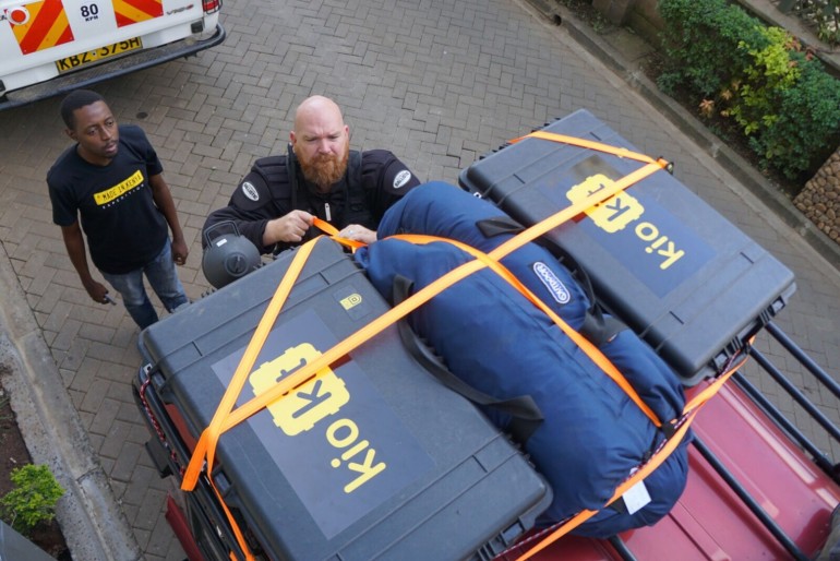
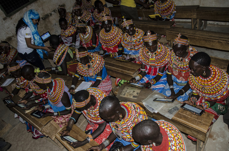
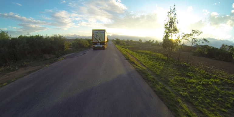
You’ve been hearing a lot about our recent trip to Uganda, and we’re not through yet! In addition to working with Hackers for Charity, connecting schools around Jinja, and wirelessly controlling underwater robots, we wanted to explore the IoT side of the BRCK, too.

MRTR in Pelican

A number of people we’re working with are keen on using BRCKs to remotely connect sensors and other objects to feed data back over the internet. Some of the uses we get most excited about are around conservation, ranging from tracking vultures to locate poaching kills to remote weather stations in the savannah.

Two projects we know of, Into the Okavango (http://intotheokavango.org) and the Mara Project (http://mara.yale.edu ; http://mamase.unesco-ihe.org), are deploying networks of sensors to monitor entire ecosystems. By tracking water quality throughout the Okavango Delta in Botswana and the Maasai Mara in Kenya, each hopes to improve our understanding of these fragile environments, and by publicly posting the data (as well as pictures of their own expeditions) on their websites, they hope to inspire further appreciation amongst those who may never get a chance to visit these amazing places in person.

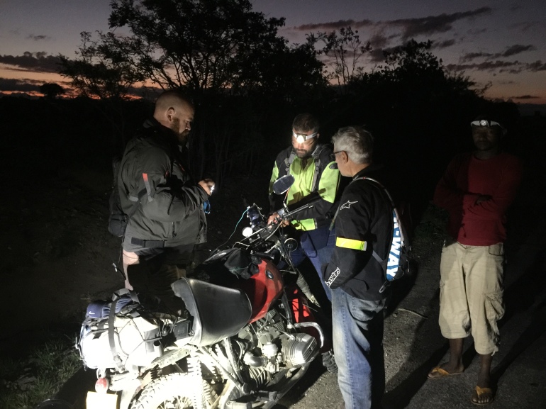
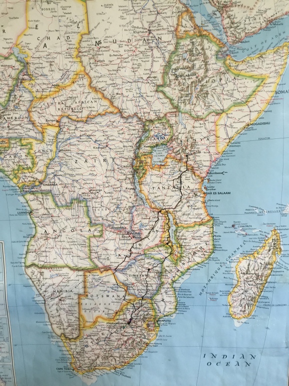
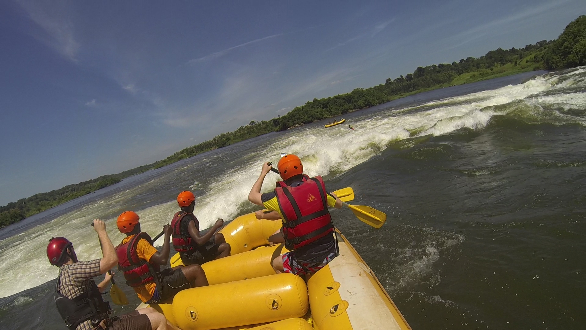
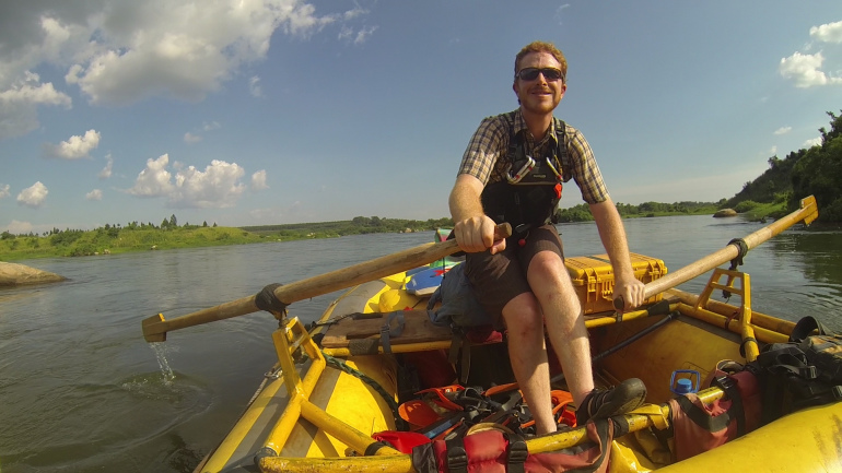
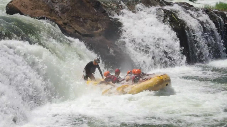
When we first started talking about going to Uganda, home to the source of the White Nile flowing out of Lake Victoria, we knew we had to find a way to get out on the river and try our hand at collecting environmental data via the BRCK ourselves. It just so happens that Paul, one of the expedition team members, was a river guide for seven years in Colorado before coming to Kenya, and had found out about an expedition being planned by Pete Meredith down the Karuma to Murchison Falls stretch of the Nile.

Paul Rowing

This stretch is home to the largest concentrations of hippos and crocodiles anywhere on the Nile, and has been rafted less than 10 times in history, only once commercially. It’s home to some of the biggest, most terrifying whitewater in Uganda – a country known for big, terrifying whitewater. Uganda is also a country that is industrializing fast, with hydroelectric power stations playing a key role in meeting fast growing energy demand.

All these new dams mean that rivers in their natural flow are disappearing quickly. The Bujagali Dam near Jinja covered 388 hectares in reservoir, flooding several miles of pristine whitewater. A new dam under construction near Karuma threatens to seriously affect the wildlife that concentrate downstream, and the Murchison stretch may no longer be runnable after 2018. With almost 85% of Uganda’s population unable to access electricity, the case against building more dams is hardly clear cut, but it does mean the time to learn from, share, and experience some of the most unique ecosystems along the Nile is running out.

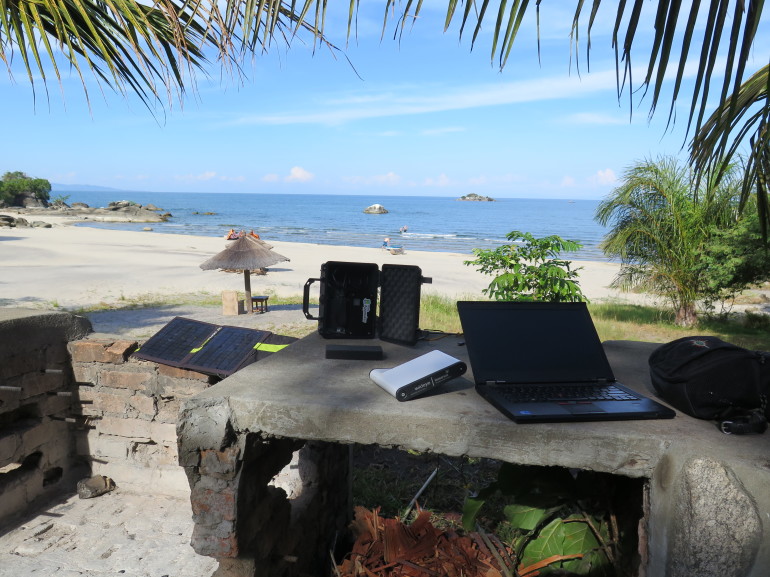
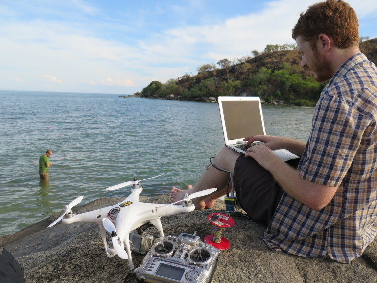
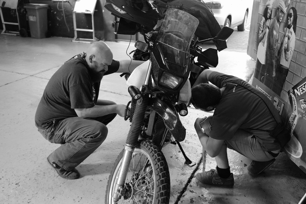
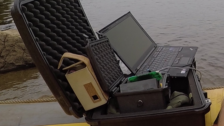
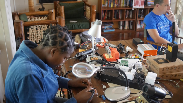
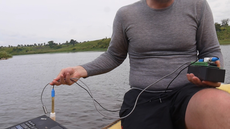
As a team of gadget-headed engineers, we figured a good first step would be to have an affordable, reliable platform for collecting and disseminating information about these ecosystems. While the BRCK itself runs on an Arduino compatible microprocessor, we included a blank AVR chip with direct access to the pins through a dedicated GPIO port on the back. In Jinja, our lead RF engineer Jackie quickly soldered up a pH and temperature sensor kit to a GPIO MRTR, and off we went.

Jackie Soldering

After much debate, and despite being a generally adventuresome and outgoing bunch, the Murchison stretch proved to be a bit too much for some of our team, most of whom had never rafted before. (Mention the word “Murchison” around here and even the local guides have to suppress a shudder of anxiety. Pete is still planning an expedition for springtime, for those with a serious bug for adventure and not too tight an attachment to this world – http://www.nalubalerafting.com/expedition.html.)

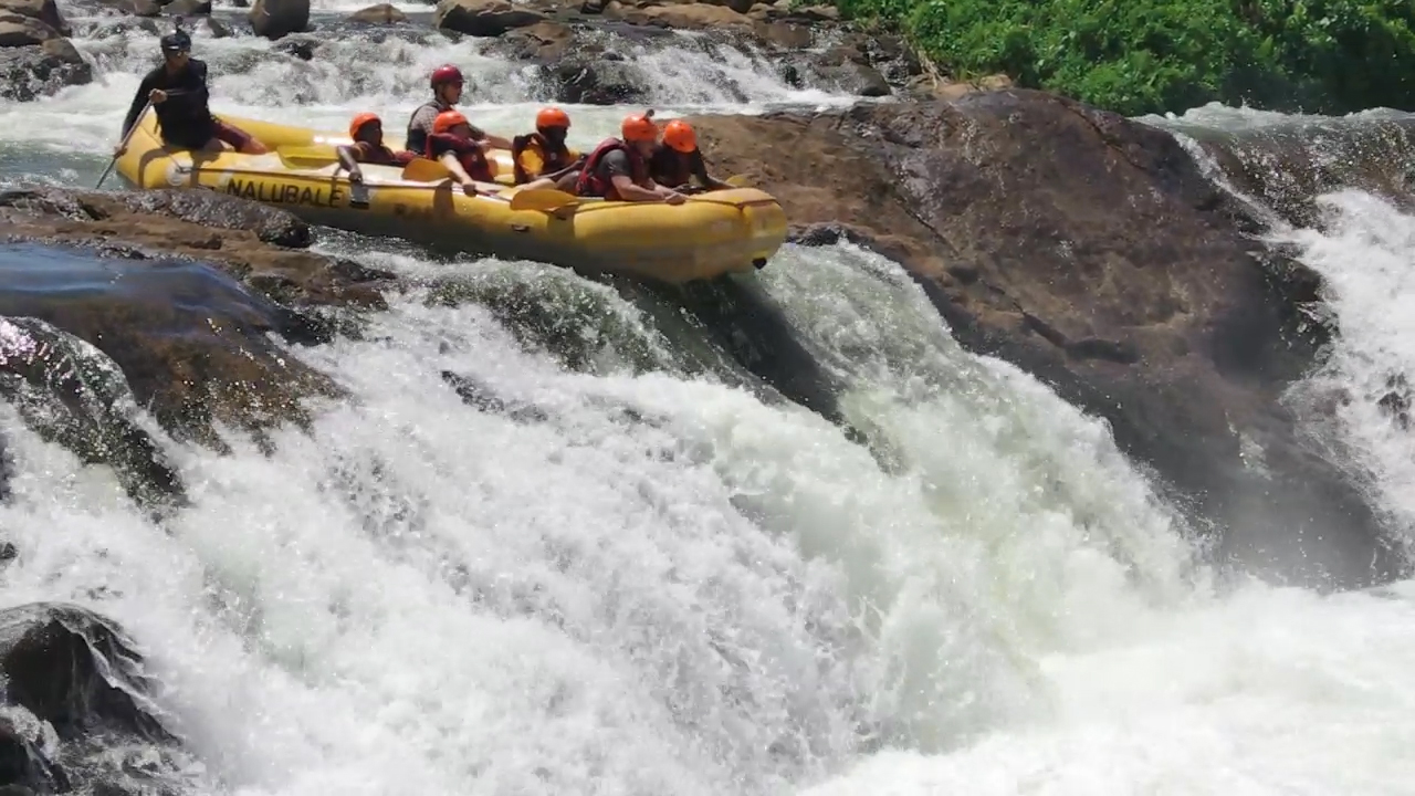
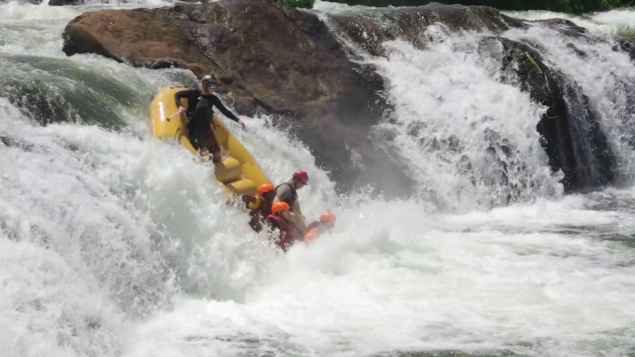
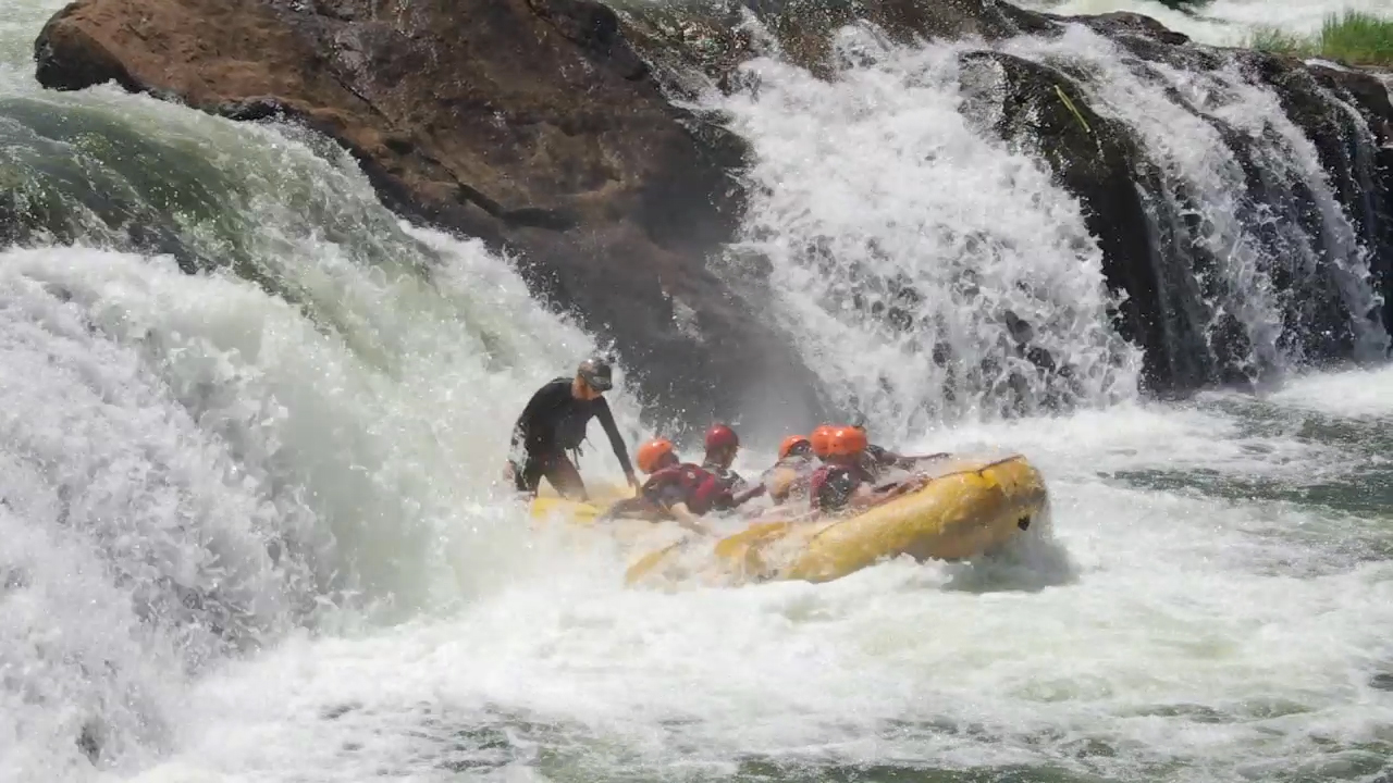
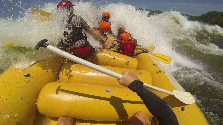
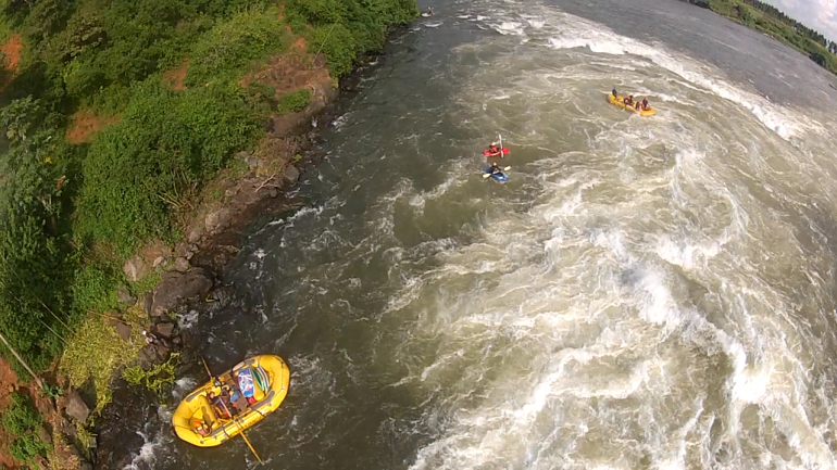
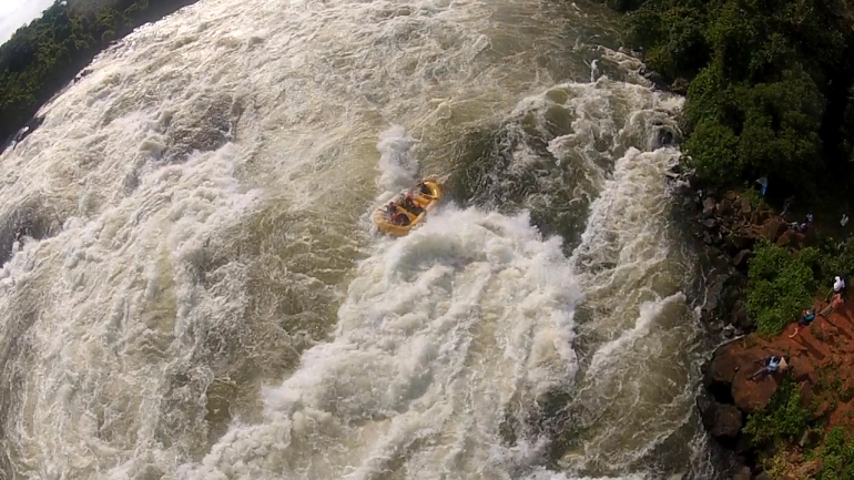
Instead, we opted to run the 30 or so kilometers of the Nile north of Jinja with Nalubale Rafting. Our goal was to get far enough away from “civilization” to test both the BRCK’s connectivity and the GPIO setup. The first day on the water, we hit five major Class IV/V rapids, including a three-meter tall, nearly vertical drop.

Big Hit 1

Big Hit 2

Drone_boats

Drone_hole

BRCK Flag

Big hole

Drop_top

Drop_middle

Drop_bottom

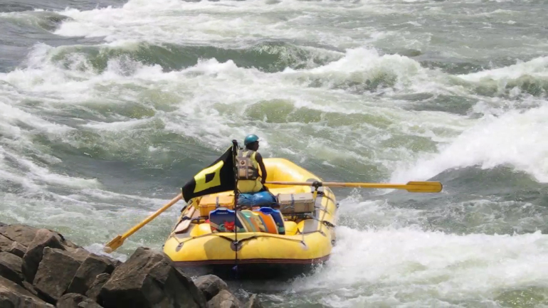
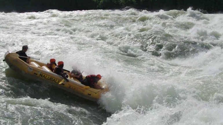
Along the way, we plugged in our MRTR and dipped our sensors into the water. Not being hydrological engineers ourselves, we weren’t quite sure what to do with any data we might collect, but we did learn some valuable design lessons around using the BRCK with the GPIO port (such as the need for a tighter connection between the MRTR case and the BRCK’s body). Ultimately, the hardware worked great, but some work remains on the software side to view our data on the web. We’ll be working on these tweaks and incorporating them, along with a means to visualize data fed through the port, into future updates.

Sensor dip

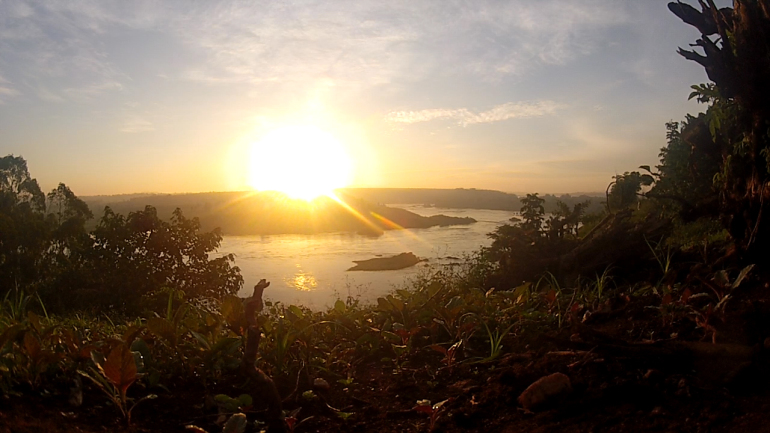
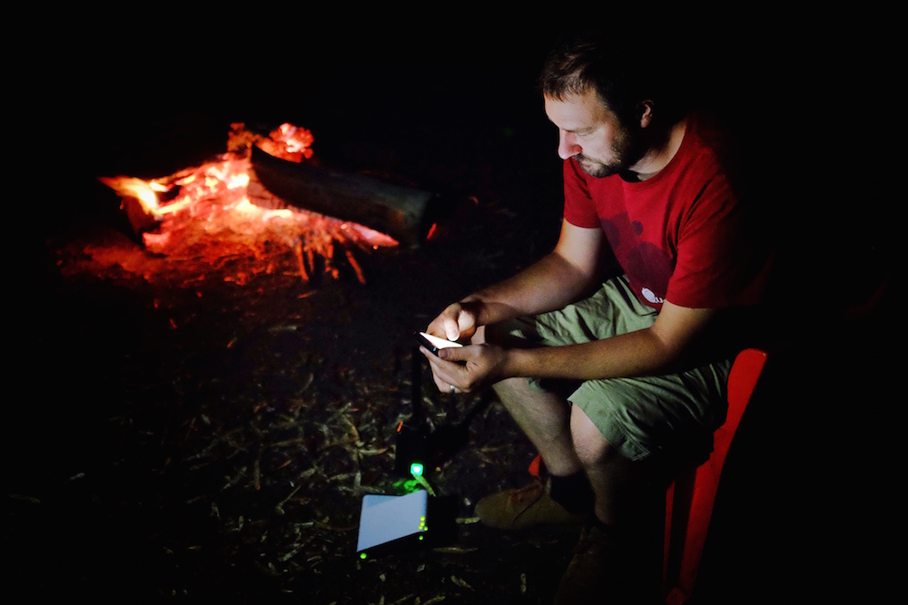
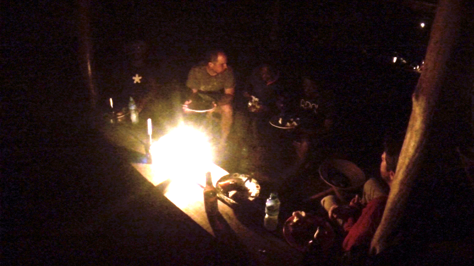
After a hard day of paddling (and no small amount of swimming, only some of which was involuntary) we found ourselves at our campsite overlooking the river. It’s hard to imagine what this place will be like in 10 years. There’s nothing quite like eating dinner around the campfire, away from the constantly connected buzz of the city to make you appreciate the stillness of the wild.

Campfire

As an expedition tech company, believe me, we get the irony. We still believe sharing these places before they disappear is the best chance we have for preserving them. There are far too many people who will never get to raft the source of the Nile, but we hope we can build a platform through which many more can experience it, if only vicariously.

Sunset

Expedition 2014 – Exploring Edtech on the Water

It’s that time of year in Kenya again – the “short rains” are coming, there’s a slight chill in the air, and every now and then, the sky opens up for a brief deluge of water. It’s hard to avoid getting wet during the rainy season here, something we’ve designed the BRCK to handle (in small doses, at least).

It just so happens that one of our key partners, Hackers for Charity – who help schools and nonprofits solve technology related problems so they can get on with their jobs – has some interesting problems they are trying to solve in their work with schools around Jinja, Uganda, at the source of the White Nile and on the shores of the largest body of water in Africa, Lake Victoria. Time for a water-bound expedition, methinks.

Going into the wild to test our products in some of the most remote and challenging environments we can find is a core principle behind how we design in Africa, for Africa; to eat our own dog food, so to speak. Last year we took a trip to the barren shores of Lake Turkana in northern Kenya to live stream one of the best views in the world of a hybrid solar eclipse. Despite having that view blocked by a massive dust storm, the BRCK performed admirably, and we learned a lot about how to design for reliability in extreme weather. You can watch the video here:

This year, we’re taking a slightly different tack. When we started making the BRCK, we found some of the greatest need for affordable, reliable connectivity is in schools. We’ve been pushing hard for solutions in the edtech scene ever since, working with partners such as eLimu, Mozilla, and Sugata Mitra’s “School in the Cloud” TED prize wish to develop projects around innovative caching solutions to cut down the costs for data, a Raspberry Pi MRTR to turn your BRCK into a remote server, and testing connectivity solutions in schools from India to Ghana.

When Johnny Long, the founder of Hackers for Charity, first contacted BRCK back in June, he showed us his own attempts to build a rugged and reliable remote connectivity device. It looked remarkably like some early BRCK prototypes. It was clear we were trying to solve the same problems, and that by working together we could make a dent in the challenges facing students in rural Uganda. We set Johnny up with a BRCK and gave him free reign to hack it however he needed to build the solutions that worked for the schools he and Hackers for Charity supports.

At last, we have the chance to work with him directly. On Sunday, six of us will load up the Land Rover and make the 12-hour journey from Nairobi to Jinja. Johnny has graciously offered to host us at the bed and breakfast he and his wife run while we set about training up the Hackers for Charity staff on the technical aspects of the BRCK, testing antennas and signal amplifiers, and ultimately working to get several local schools online.

One of these schools is on an island in Lake Victoria, an hour and a half journey from Jinja by boat. Seeing an opportunity to kill two birds with one stone, we decided to bring an OpenROV with us. We’re hoping we can work out a way to control the ROV through the Ethernet port on a BRCK, meaning we could “wirelessly” pilot the ROV through the waters of Lake Victoria. Since Ushahidi, our parent company, partnered with OpenROV to create OpenExplorer.com, a platform for sharing the fruits of grassroots exploration with the world, you’ll be able to follow the progress of the entire expedition at:

https://openexplorer.com/expedition/brckexpedition2014

As if this wasn’t enough, Jinja also happens to be at the headwaters of the White Nile, with some of the best high-volume whitewater in the world. A BRCK expedition can’t be all bed and breakfasts, so we looked up Pete Meredith, one of the leading explorers of the Nile (he’s ran it from the furthest source in Rwanda all the way to the Mediterranean), and Nalubale Rafting to help us spend a couple days exploring the river.

In addition to the edtech sphere, some of the primary use cases that are emerging for BRCK’s technology are around conservation. We’ve been talking to people who are monitoring the effects of hippo feces and wildebeest carcasses on water quality in the Maasai Mara and streaming live data on animal sightings and pH levels (and much more) in the Okavango Delta in Botswana. You can read all about the Mara Project and Into the Okavango here and here:

http://mara.yale.edu ; http://mamase.unesco-ihe.org

http://intotheokavango.org

Both of these projects have very kindly shared info about their open-source sensor package designs with us. We’ve put together our own package to test pH and water temperature, and will attempt to stream data from the river as we go. This will be a fantastic learning experience as we further develop IoT use cases for the BRCK, and we hope will prove a valuable source of insights for how we can better enable our conservation partners to inform the wider public about the amazing work they’re doing, and the importance of these fragile ecosystems.

So, with a very full docket, our soldering irons packed, and our heads and hearts full of excitement, the BRCK team is once again setting out into the wild blue yonder. Get ready to follow along – BRCK Expedition 2014 begins tomorrow!